
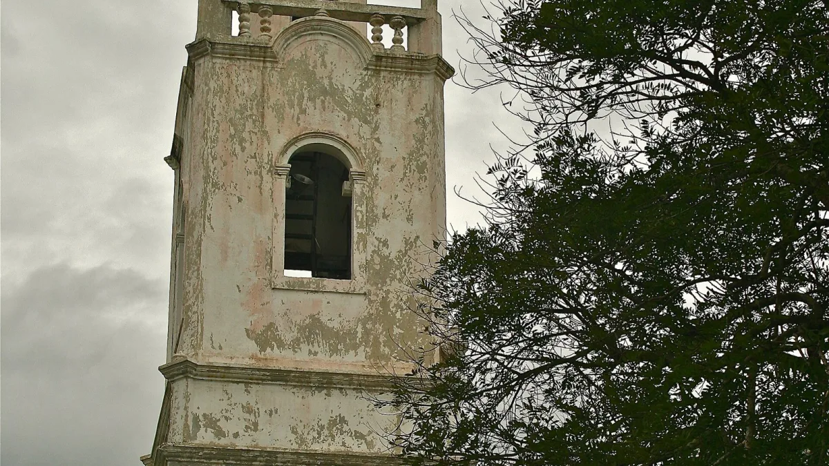
Panama has declared a state of emergency after the strongest earthquake to hit the country in decades. The magnitude 7.7 quake struck at 12:56 pm local time on Friday, October 9, near Pitaloza Arriba in Herrera province on the Azuero Peninsula. It left 27 people injured, brought down historic church towers and damaged hundreds of homes and schools. The Cabinet approved the emergency order on Saturday so ministries can move money and staff quickly.
No deaths had been reported by Saturday, but officials say the count is still preliminary as rescue teams reach isolated villages. More than 170 aftershocks have rattled the region, four of them above magnitude 6.
How the quake unfolded
The US Geological Survey first put the quake at 8.0 before revising it to 7.7. Panama's own scientists measured it at 7.2 to 7.5. The shallow focus, about 12.6 km deep, meant strong shaking spread across the Azuero Peninsula and central Panama, roughly 200 km from the Panama Canal. Tremors were felt in Costa Rica's capital San Jose and in several Colombian cities.
Within minutes, US warning centres put much of Central America's Pacific coast, along with Colombia and Ecuador, on tsunami alert. Those warnings were lifted once monitoring showed no major wave. Still, about 300 people were moved to safety on Isla Canas after the sea rose there.
Damage on the ground
The worst damage is in Herrera, Los Santos, Veraguas and Cocle provinces. In Penonome, the capital of Cocle, one tower of the historic San Juan Bautista Cathedral collapsed, and the regional government building suffered serious structural damage. In Los Santos, the colonial-era Church of San Atanasio fell. In Tonosi, a hotel and several houses were destroyed.
Roads cracked, debris blocked main routes, and many neighbourhoods lost power and water. Sinaproc, the national civil protection agency, said on Saturday that more than 426 homes had been inspected, with damage ranging from cracks to total collapse. Twenty-one health facilities were damaged, and the Education Ministry counted 188 affected schools by Friday night.
Injuries by province
Of the 27 people hurt, 17 were in Cocle and six in Los Santos, with the rest in Veraguas, Herrera and Panama Oeste. Officials described most injuries as light to moderate.
Key facts at a glance
| Time | 12:56 pm local time, Friday, October 9, 2026 |
| Magnitude | 7.7 (USGS); 7.2 to 7.5 (Panama institutes) |
| Epicentre | Near Pitaloza Arriba, Herrera, Azuero Peninsula |
| Depth | About 12.6 km |
| Injured | 27; no deaths reported so far |
| Homes inspected with damage | 426+ |
| Schools affected | 188 |
| Aftershocks | 170+, including four above M6 |
Government response
President Jose Raul Mulino visited Penonome and ordered every ministry and agency to mobilise. He said no one is ever fully prepared for a disaster like this, and urged people on social media not to use the tragedy to spread panic. Minister of the Presidency Juan Carlos Orillac said all ministers and institutions must make resources available for aid. A three-member commission will oversee relief and repairs.
Schools have been closed nationwide until engineers check buildings. Panama City's Metro Lines 1 and 2 were shut on Saturday, and Tocumen International Airport is pausing takeoffs and landings after every felt aftershock. The Panama Canal Authority said ship traffic continued normally while engineers inspected its facilities.
Sinaproc said it was not yet asking for international help, but US military aircraft have started flying tents and supplies to the Azuero region, and a team of about 20 American search-and-rescue and structural specialists was due to arrive.
Why it matters for India
The Panama Canal is a key route for global shipping, including cargo moving between Asia and the Americas, so any disruption there would be felt in freight costs worldwide. For now, canal operations are normal. Indian nationals in Panama are advised to follow local official updates and stay away from damaged buildings while aftershocks continue.
What happens next
Scientists warn that aftershocks may continue for weeks along a fault running roughly 230 km west towards Coiba Island. The government still has to put a figure on the damage and publish the formal emergency decree. School and metro reopening dates will depend on safety checks over the coming days.






Comments (0)